Yalova, Turkey's southeast, is located
in the southeastern part of the Marmara region. provinces in the north
and west of the Marmara Sea, east of Maharashtra, south of Bursa
(Orhangazi-Gemlik) and is located in the Gulf of Gemlik. Yalova, 39-40
N, 29-61 East longitude. Height is 2 meters from the sea, 926 meters
from the highest point. 0.11% of its land area with 847 km2 'covers part
of. Yalova outside the eastern shores of the plains, mountainous
terrain has a. South of the region, from west to east Izmit - Sapanca,
Kocaeli, combined with sıradaşları Samanli Mountains are covered. Many
of the hills in this mountainous terrain where the highest peak (926 m)
is at the top Beşpınar.
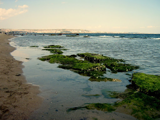
North of
the southwestern province of Yalova is surrounded by the Marmara Sea up
to the limits. A property does not coasts are indented.
vegetation,
shrubs, and forests are the province. Mountains, north and south of the
valley shrubs Samanli found in them, strips and pieces are found
intermittently along the base of this mass.
The
steep slopes in the south of Yalova's completely covered with a lush
forest cover. Forests cover about 5% of the province. Forested areas,
usually beech, oak, hornbeam, dogwood, chestnut and lime trees is seen.
Located
east of Yalova province in Marmara Region, the climate, the macro - as
the type of air conditioning, is the nature of a transition between the
Mediterranean and Black Sea climates. Yalova's climate, in some periods,
reflects the properties of terrestrial climate. Arrivals from the north
and south of Yalova, in the three main types of air flow is dominant in
a quiet quality. cities, summers are hot and dry, winters warm and
rainy.
According to today's central district with the provincial administrative bölünüğe consists of 6 districts.
districts;
Central District
Altinova
Pears
Cinarcik
Ciftlikkoy
Termal
POPULATION

Yalova
province between the years 1990-1997 the population growth rate is
approximately 2-fold increased, with 113,417 of those dates is a 7-year
period the overall population increased to 163,916. This is the most
important reason for the increase in the past is that the status of
provincial status in the district of the province in 1995. Population
growth rate on 17 August 1999 came to a halt with the earthquake, have
had some reduction in the immediate aftermath of the earthquake in 2000,
the province also provided temporary housing solutions for the problem
with the population trend has been observed to increase again. The
amount of this increase, however, fallen far short of pre-earthquake
rates. Yalova population is examined in terms of gender, male population
than female population in the center of the network starts, but the
villages have changed the balance in favor of the male population and
the total male population was more than the total female population.
If the population is examined by age, over 50% of the population is among 10-39 years.
SIS
Urban Population Growth Rate Population Growth Rate Index, Index, and
the evaluation due in 2005, Yalova city population was 190,826; in 2020
is expected to be 279,430. In terms of population movements, in 2000,
41% of the population in the villages, the city, falling 59%, whereas in
2005 39% of the population in villages, 61% of the city and live in
2020 villages in 34% of the population, 66% percent is expected to live
in the city.
LOCAL DISHES
Of
the local cuisine dishes that are unique in Yalova, Pavle (the root of
boiled cabbage leaves), rocket (soup made from corn flour), kale, lunch,
luhu şuşkey (corn tortillas, shredded cabbage dish), Çirbuli
(Kırmızıbiberli eggs), Lalanga (pan-fried in a thin pasta dinner),
Çubiyiş Gayin (chestnut dinner) include. The pope desserts (sweet milk
and flour mixture), Silohto (dumpling), Paponi (sweet made of flour and
sugar), Meçavçevi tray (walnut dumplings), Yalova and other specialties.
The local cuisine, a variety of
Yalova province of those who migrate here enjoy their own culture and
social structure of the request, Yalova, gave birth to a rich culinary
culture.